INTRODUCTION:
The 1,148km2 Sagarmatha National Park, located in the eastern Nepali Himalayas, is a UNESCO World Heritage Site.
The name Mount Everest in Nepali is known as Sagarmatha; it is formed from the terms sagar, which means “sky,” and matha, which means “head.” Westerners refer to the mountain and its surroundings as Everest.
With the peak of Everest at just over 8,800 metres above sea level and the Sagarmatha National Park’s lowest point at just over 2,800 metres, it is the highest national park in the world. The park’s distinctive landscape of forests, arid plains, and snow-capped hills is home to about 6,000 native Sherpas as well as a variety of other animals.
The area now receives a significant increase in tourists every year since the park was created in 1976 and listed as a world heritage site in 1979. The park and its residents are now more dependent on tourism than they were in 1979, when there were only about 3,500 tourists annually.
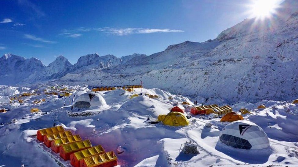
Most tourists to the area have plans to walk to Everest Base Camp or on one of the many other treks in the region, like the Gokyo Lakes, Island Peak, or Three Passes treks.
Park Landscape
The Sagarmatha National Park’s landscape varies greatly due to its elevation range of over 6,000m, ranging from lush forests in the lower, southern regions to barren lands that make up most of the valleys, and finally to the ice and snow of the uppermost regions.
If you visit the park, you’ll quickly realise that the vast bulk of your time will be spent on arid territory that extends for 5,000 metres, with little patches of grazing area interspersed therein. You will be in snow country above 5,800 metres, where plants can no longer grow, and only the bold and crazy dare to venture! The Sagarmatha National Park has a vast height range, ranging from lush forests in the lower, southern areas to barren lands that make up the majority of the park.
The Gokyo Lakes, the highest freshwater lake system in the world, are located in the Dudh Kosi Valley to the west of the park. The Ngozumpa Glacier, the largest in the Himalayas and the largest permanent body of ice in the world, is one of many glaciers that are present in the park in addition to the well-known lakes.
The 7 peaks of Everest, Lhotse, Cho Oyu, Thamserku, Nuptse, Amadablam, and Pumori, each above 6,000 metres high, are the park’s principal draws.
Flora and Fauna
The park’s lower regions are distinguished by juniper, pine, and fir scented forests. Except for a few rhododendron-covered hillsides in the early spring, the vegetation significantly thins out as you travel further north and gain elevation. Even higher up, the vegetation changes into tiny bushes, and at the top, only mosses and lichens remain. Bird life International has additionally designated the park as an Important Bird Area due to the presence of at least 118 different bird species in the lower woodlands. Additionally, the region is home to other endangered mammal species like the red panda, Himalayan black bear, and snow leopard. Yaks are frequently seen throughout the park, partly because the Sherpas use them to carry cargo up and down the mountains.
Culture
The Sagarmatha National Park’s surrounding area has been inhabited by Tibetan Buddhist Sherpas for the past four centuries. Because of their beliefs and their unbreakable spiritual ties to the land they live on, they have maintained their distinctive culture and religion to this day and continue to advocate for the preservation of the park. Since it is illegal to slaughter animals in the park, the majority of the meals are made of grains and vegetables.
Tourism and the future of the Park
Generally speaking, the rise in visitors to the park each year has greatly benefited the local population as well as the infrastructure in the area. Following Sir Edmund Hillary and Tenzing Norgay’s and other climbers’ summits, the construction of the Lukla Airport and other schools was sparked by the flood of visitors, who also brought a continuous stream of cash and investment into the area.
Even at the highest altitudes, Wi-Fi is readily available in tea houses and restaurants, and almost the entire park is covered by 3G mobile service. The Everest Base Camp Trek has grown to be one of the most famous and well-known in the world, and many tour operators, both foreign and local, now operate in the area.
Only a few individuals die on hikes in the area each year, most often from underlying illnesses or altitude sickness, thanks to improvements in safety. Despite the fact that the summit ascent is still quite difficult, it is now more normal to witness lines of people waiting to get there. Despite the high mortality toll in recent years brought on by the two avalanches in 2014 and 2015, as well as the infamous year 1996, this remains the case.
With an ever-increasing need for new hotels, trails, energy, and rubbish disposal, tourism has taken a toll on the park in recent years. We inquire because the park’s environment is vulnerable.
